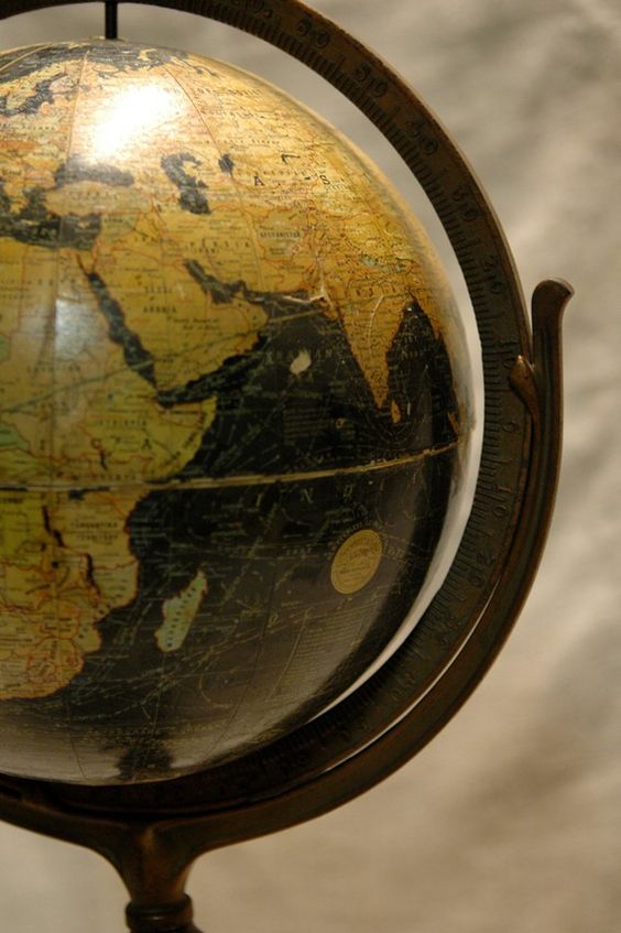
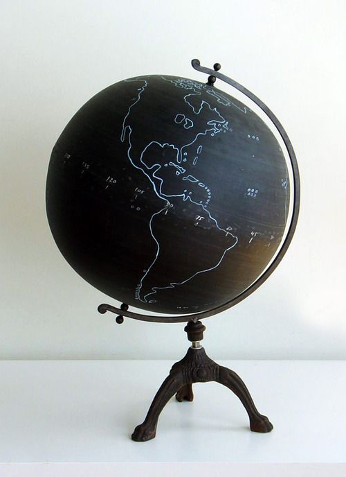
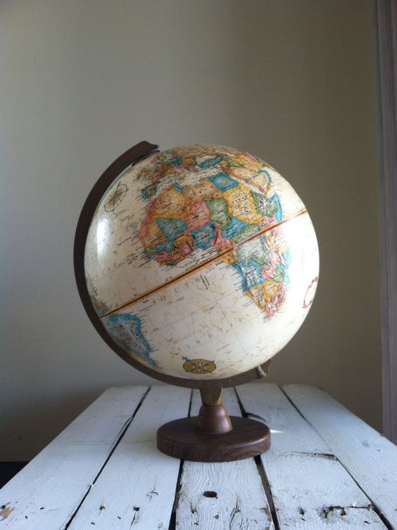
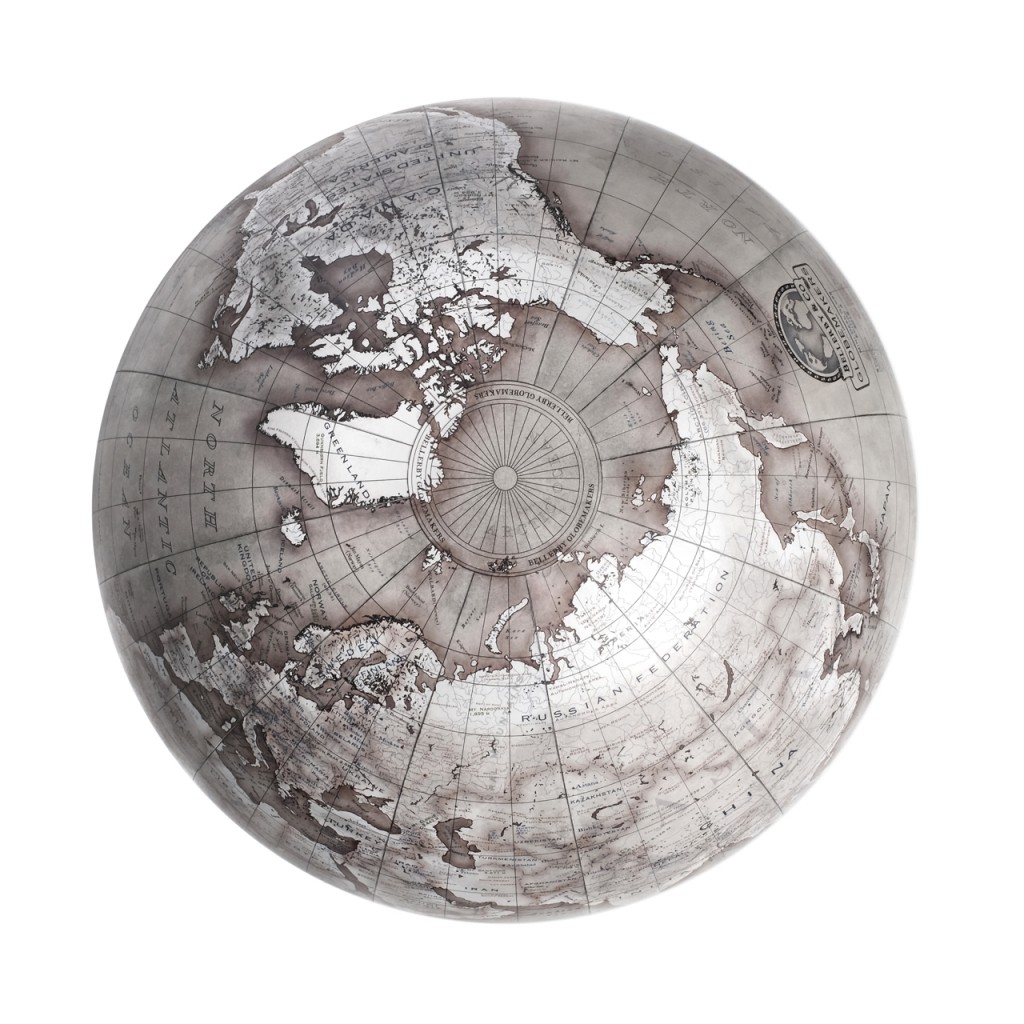
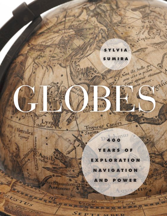
LES GLOBES, globes of 1623 nowadays !


This is the oldest known terrestrial globe to be made in China. It dates from 1623.
Murray Hudson talks about her 1831 corresponding terrestrial and celestial globes, made by James Wilson, America's first world manufacturer. These globes are now exposed to “World in your hands” world exhibition in downtown Lynchburg, Virginia.

History Globes..
What may be surprising to some is how long globes were actually around. It is not known how or why the American myth of Columbus proving the Earth was round by sailing west from Europe to reach India began. It is true that Columbus thought he had landed in India when he reached the Americas (so, by calling the native Indians), it is true that he was trying to prove to the rest of Europe that the Earth is a sphere. This concept had already been long believed by the most educated people of Columbus time. It is believed that the concept of a spherical Earth goes as far as 570 BC, when ancient Greek philosopher Pythagoras first hypothesis about this idea. The theory held in ancient Greece, when philosophers later and universal truth seekers such as Plato and Aristotle offered scientific evidence, as the shadow of the Earth being round during a lunar eclipse.
The first globes back as far as 1000 years ago. The first known celestial globes were globes, made in order to follow the stars and planets in the night sky. This is important for early nautical navigation.
The first known terrestrial globe which is still today was made 1492, Nuremberg, in Germany, by cartographer Martin Behaim. Meanwhile, it was believed that the earth was the center of the universe. However, by astronomers such as Nicolas Copernicus, Johannes Kepler, Galileo and scientists like Isaac Newton, it was finally understood that our world revolved around the sun and that a force called gravity affected the movement of all the heavenly bodies.
One of the biggest influences on terrestrial globes was Flemish cartographer Gerardus Mercator. Mercator has developed a card type called a Mercator projection, using lines of longitude and latitude to simplify map reading and to help make navigation easier in the world.
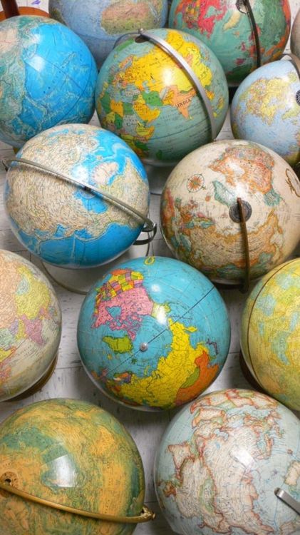
Evolution des Globes..
The first European globe manufacturers were educated cartographers and teachers, often hired by prestigious lordships, emperors, kings or queens. old globes and time are carefully handcrafted with great attention to detail and were made primarily for the rich and powerful. Globes has become a status symbol for households and people of upper class importance.
During the 16th century, southern Germany has become the world manufacturing center. By the 17th century, globe decision was extended to countries such as Holland, France and Italy. England followed closely and 1810, James Wilson of Chicago became the first American to produce globes.
It was during the second half of the 1800 when the globes have finally started to become available to the middle class. At that time, Chicago became the US leader in the manufacture of globe. It has become a fashion trend for men to wear a pocket globe, like to wear a pocket watch.
With new technologies in the manufacturing process, globes could now be mass produced. These three-dimensional maps of the Earth have become commonplace today as teaching tools in schools, as a decor to fashion houses for the middle class and miniature globes becomes even toys for children.
How to date a globe..
Because the Globes were announced as updated, they were never stamped with a date. The way the collectors vintage globes date is by the names and geographic and political boundaries that displays. Examples of historical events dating to help globes made before or after each event:
1867 – Alaska becomes Russian territory
1873 – Yellowstone became a national park
1899 – Philippines et Porto Rico (US)
1914 – 1924 (only) Saint Petersburg, Russia appointed “Petrograd”
1919 – Treaty of Versailles in Europe. Polish corridor, Balkan States, Czechoslovakia formed
1924 – 1991 St. Petersburg in Russia called Leningrad
1976 – North and South Vietnam to become unified Vietnam
1960 – French Equatorial Africa (part), Ubangi-Shari dissolves and becomes the Central African Republic. The Middle East and on the African continent suffered much turmoil and change, which makes the current events that occur there a good source for world dating.

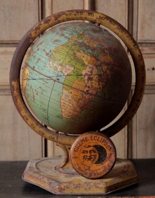
 1895 Rare French Clock Globe.
In solid geometry, a sphere is a surface consisting of all points situated at a same distance from a point called the center. The value of this distance to the center is called the radius of the sphere. The spherical geometry is the science that studies the properties of spheres. The Earth can, first approximation, be modeled by a sphere of radius around 6 371 km. More generally mathematics, in a metric space, a sphere is the set of points at the same distance from a center. Their shape can then be very different from the usual round. A sphere is also a degenerate ellipsoid.
Hipparchus explains how to find a place on Earth with two numbers and teaches the stereographic projection : a method to draw a world map. ” Mathematics compares the most diverse phenomena and discover the secret analogies between them.” — J.B.J. Fourier

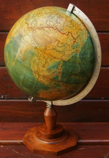
Planetary globe, 1820.
Woman puts a wet paper around’ a hollow wooden globe, it is then treated with tallow and two separate halves. M / S as it is put on a tip and the two halves are glued together. The globe then receives 9 layers of plaster. It is taken to another department where the world map is stuck in sections.
The woman puts on a tip and back door to be placed on an axis. Various air as it is verni.Vue different globes size. FILM ID: 1265,12

https://youtu.be/PeDA3qjTUkg
Video : Fascinating shows the process of laborious Globe Making In 1955 DESIGN
While the rest of humanity does its best to blow up the world, these British craftsmen as new construction. Just north of London, some 60.000 globes were hand made each year in the years 1950.
In this film 1955 presented by British Pathé , we get an overview of the process and the’ history , step by step what it takes to create these magnificent globes.
The first known globe was made 1492 and are usually made of wood and coated with nine separate layers of plaster before being transferred to another department where recovery carpet is glued to. The majority of the globes go to school and are printed in all languages.

Globe mire TDF (Broadcasting France) adopted by all TV channels, in the years 80.
Russian Globe on wooden stand. 1930
 GERMAN GLOBE “POCKET”, c. early 20th c., sign “The globe, Verlag v. FROM. & B. (7,5 cm) Earth 3 is made of the card, mounted in each hemisphere with 12 lithographed gores and polar cap. The earth is ocher and green water, and many ocean currents are represented. The condition is good noting rubbed spots. (9022 ) 495 $.
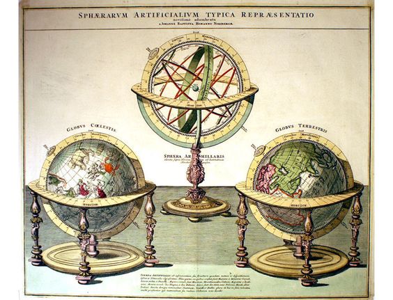
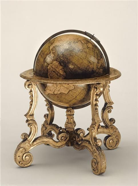
This rare painting is a 18thC. study of a pair of terrestrial and celestial globes and armillary sphere Ptolemaic representing the earth as a globe in the center green.
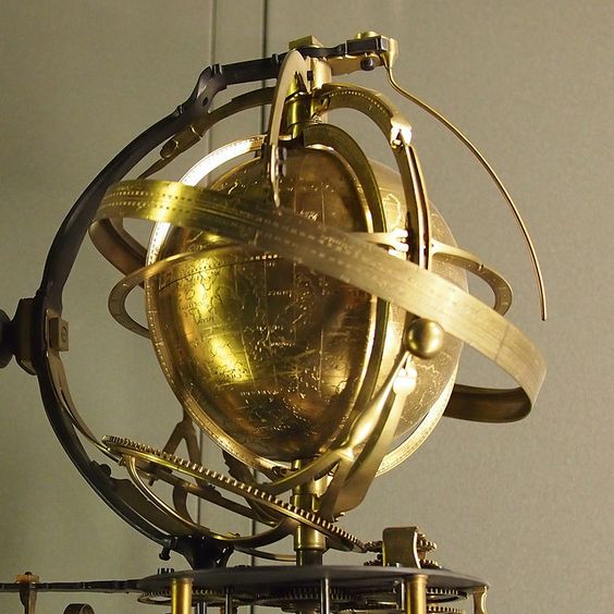
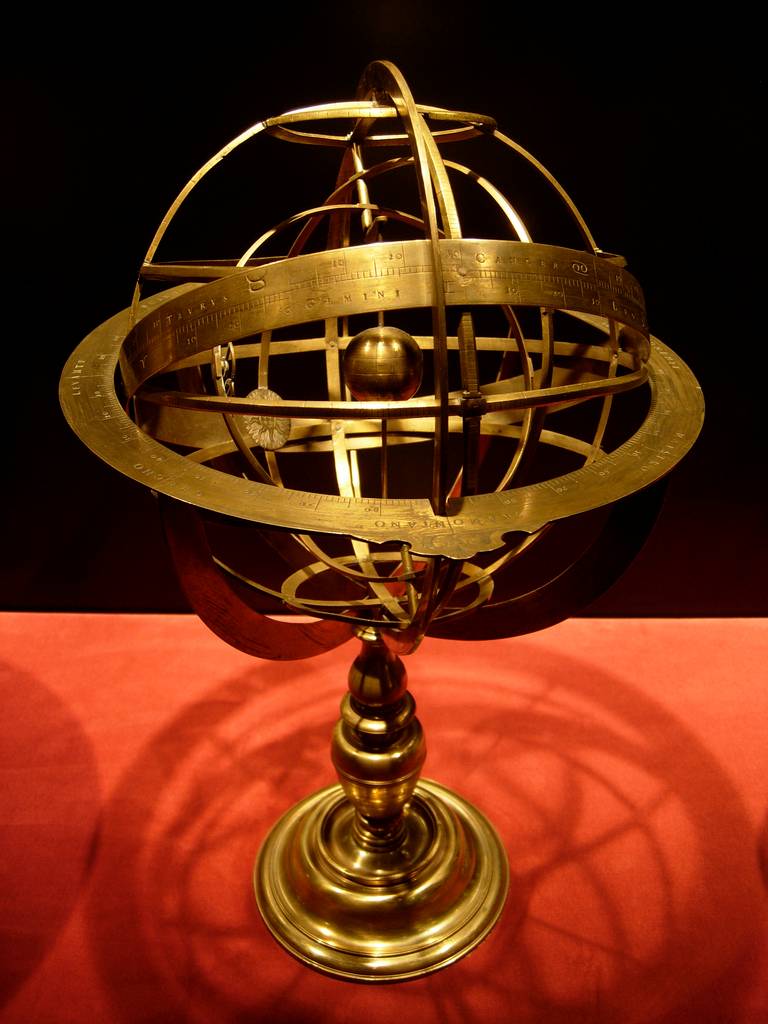
It displays various rings for the tropics,Ecuador, the Arctic and Antarctic in the solstices and equinoxes rings (which are contained in the ecliptic circle), then the meridian circle, then the circle of the horizon.
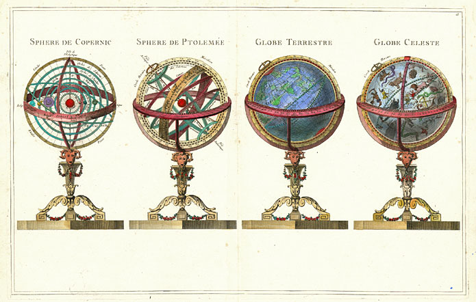
Spheres and Globes. Lattre, Jean; good, Rigobert, 1727-1794, 1791
Sphere of Copernicus. Sphere of Ptolemy. Earth. Celestial globe.

terrestrial and celestial globe supported by a triangular base in 3 dolphins and winds, controlled 1786 by Louis XVI for the instruction Edme Mentelle, Versailles, National Museum of the castles of Versailles and Trianon.
The eighteenth century was the golden age in France for manufacturers of globes. At Versailles, there are two important manuscripts globes ordered by Louis XVI to the dolphin including this one. By order of the 9 mars 1786, Educational Dauphin, Louis XVI commanded the engineer Jean Tobie Mercklein a new "world according to the measurements and proportions to be given by Mr. Mentelle".
terrestrial and celestial globe
This globe measuring 2m40 tall and 1.30m wide. The concave triangular base is decorated with a banner bearing the signs of the zodiac painted stucco bronze green color and separated by golden patterns. This tag supports three dolphins whose tails erect support the horizon table. In the center, 4 golden blowing winds seem to support an iron arc provided with 3 even metal rollers upon which the meridian. The globe itself drawn and painted by hand occupies a considerable volume. It consists of a globe in relief for the land surface and the ocean depths nested in 2 hemispherical. The upper cap represents the old world, the lower cap is the new World. Inside these caps form a celestial globe on which are drawn and painted the constellations and zodiac signs. Originality consists both in the construction of a globe in relief and the presence of mobile compartments now extinct cardboard that were adapted by screws on the caps. There was for the political geography, Physical and old.
Edme Mentelle was a self-taught, ignorant of foreign languages who devoted his life to the teaching of geography and history. There was pay the deposit of marine maps all documents necessary for the realization of this globe.
globe Table

this Cosmophere 1824 consists of a printed earth, put into a revolving glass celestial globe. It was invented by Dr. William Muller, Staff of the Royal Hanoverian Engineers Woolwich, and manufactured by Cary Brothers.
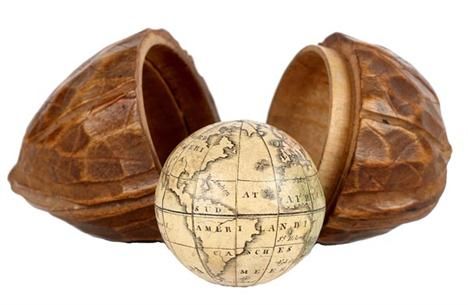
Carl Johann Sigmund Bauer (1780-1857), German / German miniature terrestrial globe pocket, in case of the form of nuts, 1,25 inch globe, early 19th century, Nuremburg [Germany]
Globe drawn on the comments of L'Isle geographer, dedicated to the Duke of Chartres, Dolphin Room
1first quarter 18th century // DATE 1700
18century / Europe
TECHNICAL / MATERIAL // papier
DIMENSIONS / Height : 0.58 mwidth : 0.4 mProfondeur : 0.4 m
LOCATION / Versailles, Palaces of Versailles and Trianon
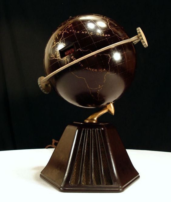
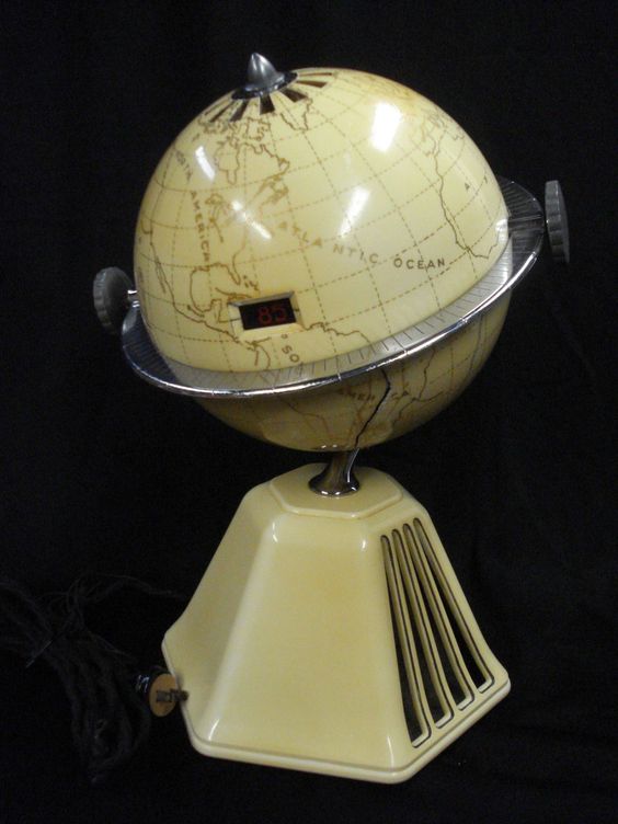
Vintage 1933 Raymond Loewy New World Colonial Globe Radio Art Deco Bakelite Map

The globe is in a box painted graduated meridian circle into four quadrants, contained in a table-shaped holder tin drum, the horizon painted degrees showing, days of the month, the houses of the zodiac, and compass directions. The exterior of the drum is painted with astronomical diagrams of eclipses of the sun and moon, the ecliptic, the equatorial coordinate system used to map the celestial objects, and the path of the sun relative to Amsterdam. The globe has twelve gores and two polar caps, Greenwich meridian and the equatorial graduated in degrees, ecliptic graduated in degrees 0-360 with signs for the houses of the zodiac, continents variously and brightly. Place names are in Dutch.
This world was created as an educational device for Dutch students to study geography and astronomy. He is credited with the cartridge CL van Balen, who wrote textbooks on mathematics and geography and edited the main Dutch school atlases in use for decades during the first half of the 20th century. The globe and school atlases were published by JB Wolters, which was founded in Groningen 1836 que le Schoolbook Publishing House; as indicated by his name, it was as a publisher of educational and training materials. Over the following decades, JB Wolters has become a major producer of textbooks and school materials, opening branches in The Hague 1915 and Jakarta, Indonesia, in 1920. The company is still in existence today as Wolters Kluwer NV, currently second 'Netherlands's largest publisher.
Titles of astronomical charts: Sunset and Lunar Eclipse, Ecliptica, ordinates system, Jobs Sun Amsterdam Eclipses du Soleil et de la Lune, ecliptic, Equatorial coordinate system, Orbits the Sun to Amsterdam.
Cartridge: porte AARDGLOBE CL VAN BALEN JB Wolters Groningen
[World Globe CL van Balen. JB Wolters, Groningen].


A Pocket Globe opening, manufactured by Holbrook Device Manufacturing Co. around 1830-59.
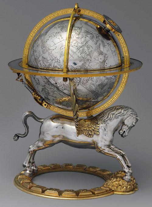
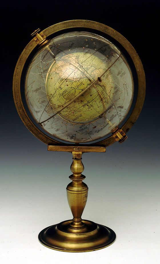
celestial globe with a clock by Gerhard Emmoser 1579 .
Although the fall of the Roman Empire has led to a cessation of production and use of armillary spheres for centuries in Europe, Greek learning was preserved and refined in what is now the Islamic world. The spheres were reintroduced in Europe much during the Renaissance by Islamic Spain scientific, towards the end of the tenth century.
A created animated 2011-2012 to the Science Museum of the History of Oxford visualize dependencies seasons for visible signs of the zodiac and the correlation to the ecliptic (path of the sun).
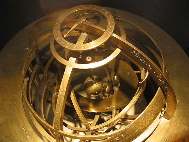

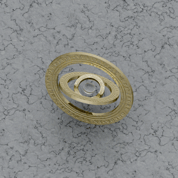
An armillary sphere (variations are known as spherical astrolabe, vest or Armil) is a model of objects in the sky (in the celestial sphere), consisting of a spherical part of rings, centered on the Earth or the Sun., representing lines of celestial longitude and latitude astronomically and other important features such as the ecliptic. As such, it differs from a celestial globe, which is a smooth sphere whose main aim is to map the constellations.
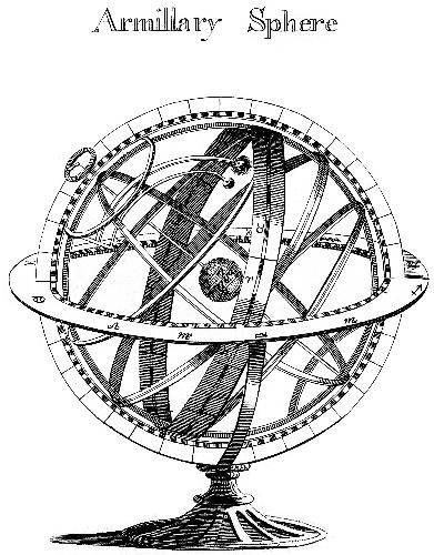
With Earth as the center, an armillary sphere is known as the Ptolemaic.
With the sun as center, it is known as Copernican.

Blue glass globe with frosted continents in relief.

Globe Boule Disco.

GLOBE ~ WILLIAMS & HAYDEN POCKET LAND

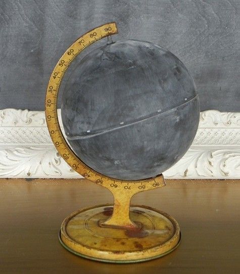
Vintage Globe Blackboard


One of the world's last traditional Globemakers || Bellerby & Co, London.


added 17 sept. 2015
In the studio with one of the worlds last remaining traditional globe makers,
making modern globes artisan and handmade painted world.

©Museum of the History of Science, Oxford Selenographia Moon Globe,
by John Russell, London, 1797.
Library of Université Laval recorded on Geography:
The concept of the earth as a sphere has been around for centuries, emerging at the time of Pythagoras in the sixth century BC, and eventually become dominant as other thinkers of the ancient world, including Plato and Aristotle, accepted the idea. The first record of a real globe is being made in verse, written by the poet Aratus of Soli, which describes a celestial sphere of stars by the Greek astronomer Eudoxus of Cnidus (towards 408-355 BC).

All maps of the world-they are false ?
Sorry to disappoint you, but actually, world maps do not represent the reality of our Earth, whether in terms of distances from a point to another, or…
but actually, world maps do not represent the reality of our Earth, whether in terms of distances from one point to another, or at the area of countries. So, if you really want to see the reality, the best solution is to observe a globe.
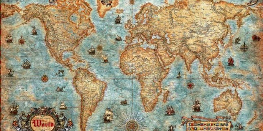
We worth, the card is more convenient than the globe, if only for the transport and use of land. However, and this is the great dilemma cartographers, represent the spherical Earth on a flat surface is not easy. Different cartographers have developed many projections which have their share of compromise. Spread the word, a map always deform some parts of the world who are there will be projected.
Vox website had a very interesting explanatory video (visible at end of article), especially for beginners in this field. The example has been taken is that of Mercator, famous simply because it is the most used card, whether in schools, in books and even on Google Maps !
When developing its Gerardus Mercator world map 1569, it wishes to preserve directions, simply because the world map has been designed to be used for navigation. When you draw a straight line connecting two points on either side of an ocean, we realize that when we transpose this trip on a globe, it is not the most direct. However, this trip will be the safest in the management level, especially if one browses (as then) with a compass and it was the goal.
If this card well preserves angles and so the shapes of continents, it distorts distances and areas. So, starting with Ecuador and heading towards the poles (South and North), strains are increasingly pronounced (see below). The most striking example is the following : on the map of Mercator, Greenland and Africa seem to have a similar size, gold in reality, Africa is 14 times bigger than Greenland. amazing is not ???
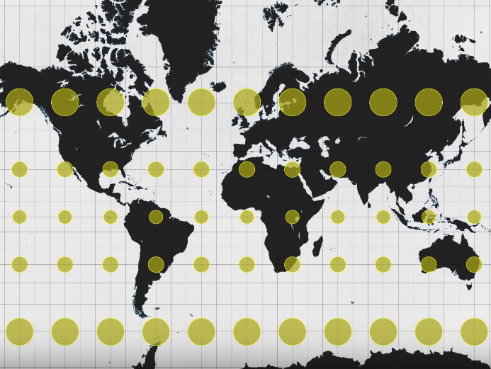 The Mercator projection distorts distances and areas
(Image credit : Vox)
According to recent critics, Mercator map will be imposed until today for geopolitical reasons. Indeed, Northern Hemisphere where these former colonial powers is advantageously deformed compared to southern countries which appear in large part smaller. in short, it is a representation of the skewed world for preserving imperialism and domination.
Not perfect, the projection that allows to make better reflect the world of reality is that of Gall-Peters (Twentieth century) which attempts to take into account the actual size of continents. This one, also called "equivalent projection", allows a better comparison of continents and states areas as evidenced by the document below :
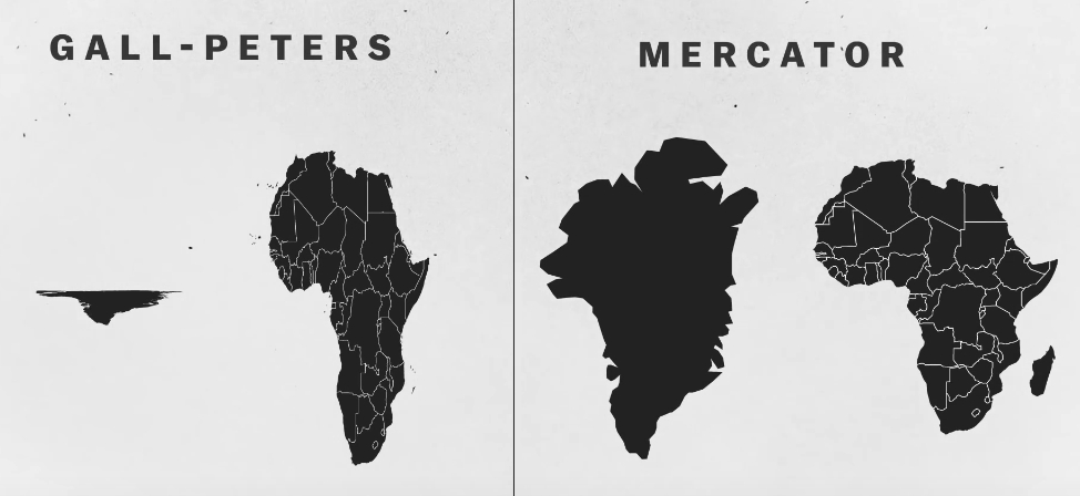
Greenland has lost its Grandeur ! following projection, is not it ?
(Image credit : Vox)
However, the Mercator projection or, nor that of Gall-Peters are used by cartographers from around 30 years. Indeed since 1988, the National Geographic Society adopted
the Winkel Tripel projection, because it offers a good balance between size and shape.
Here is the video tutorial published by Vox :
Sources : Slate – France TV Info.
Bonus !
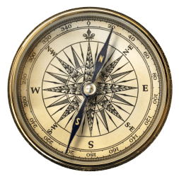
Gif – compass compass